On the Records: Mapping Forest Fires
/https://static.texastribune.org/media/images/fires-all.jpg)
Since 2009, the Texas Forest Service has helped douse more than 2,600 wildfires like those scorching West Texas in recent days. By far, debris burning is the most common cause of the fires, records show.
Using the agency’s Google Earth file, we extracted data on each fire’s cause, location, date and duration. The file also lists the number of homes lost in each incident, as well as the number of acres damaged.
The fires in the database affected nearly a half-million acres and destroyed 300 homes. Here are the causes as categorized by the agency: Debris burning (1,078), miscellaneous (627), incendiary (350), lightning (259), equipment use (233), children (38), railroads (25), smoking (24).
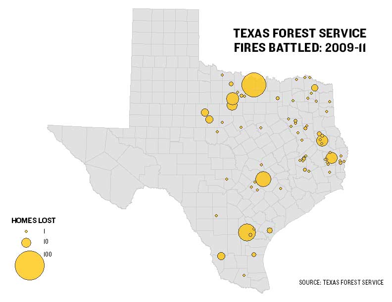
This view of the map uses proportional symbols to visualize the numbers of homes lost in each blaze. Larger symbols represent more damaging fires. Notice the largest symbol is over the North Texas’ Montague County, site of a massive fire in 2009 that destroyed 69 homes and burned 31,000 acres.
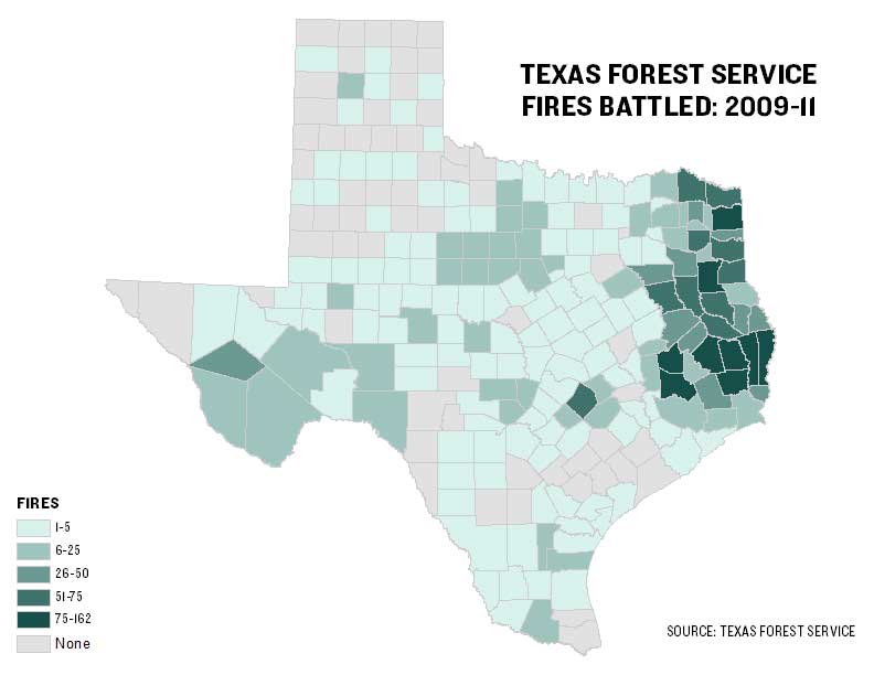
This view shows the counties where the forest service, which is facing the budget axe this legislative session, responded to the most fires. Darker shades represent more incidents. Jasper County, deep in the Piney Woods of East Texas, led other counties with 164, followed by Hardin (118), Cass (104), Montgomery (104) and Newton (100).
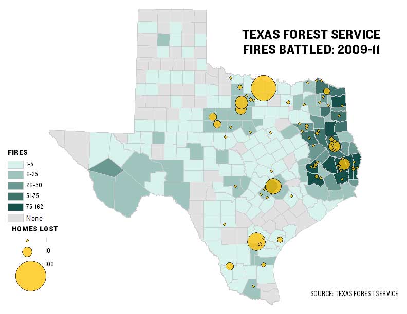
This map displays both visualizations (see a high-resolution PDF here):
Let us know if you have feedback or ideas for other data-related content, and be sure to follow @TribData on Twitter for updates.
Texas Tribune donors or members may be quoted or mentioned in our stories, or may be the subject of them. For a complete list of contributors, click here.
Information about the authors
/https://static.texastribune.org/media/profiles/TxTrib-Staff_0016_StilesMatt800.jpg)
Matt Stiles
Reporter and News Apps Editor
Learn about The Texas Tribune’s policies, including our partnership with The Trust Project to increase transparency in news.